

Thunderstorms, strong winds rolling into Southern Interior
Thunderstorms and gusting winds are set to hit the Okanagan and the entire Interior ahead of the weekend.
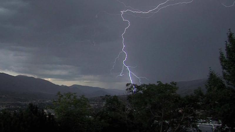
Environment Canada said widespread southwesterly winds, coupled with a cold front that could bring dry lightning, is set to blow into the Interior Thursday.
The system will develop Thursday morning, move to the Central Interior by midday, and then the Southern Interior Friday.
The system could result in southwesterly winds gusting up to 70 kilometres per hour and thunderstorms as the storms move through the region.
The weather agency said the main hazard will be in areas with drought-stricken trees that could blow over in the wind or be ignited by lightning.
The weather may also blow loose items around, cause tree branches to break, spark new wildfires, and create challenging boating conditions.
The system may also cause challenges on the Okanagan Connector, the Coquihalla, Highway 3 and the Trans-Canada Highway. Travellers are advised to check weather forecasts and road conditions at DriveBC.
Environment Canada advises people to monitor the forecast and stay indoors during storms.
The new system builds on the existing heat warning and the smoky skies bulletin that have been in place for the North Okanagan.
The heat wave is expected to continue through Thursday, when the daytime high will reach 38, before returning to more seasonable temperatures.
The skies are still filled with smoke from area wildfires, which can be harmful to everyone but especially the elderly, children, people with pre-existing conditions, pregnant women, and people who work outdoors.
People are advised to limit their time outside if possible.
The weather agency stated Wednesday that the smoke could dissipate within the next 24 to 48 hours.