

UPDATE: White Rock Lake fire size up by 14,000 hectares, rain reduces activity for short term
UPDATE: Aug. 17 10:00 a.m.
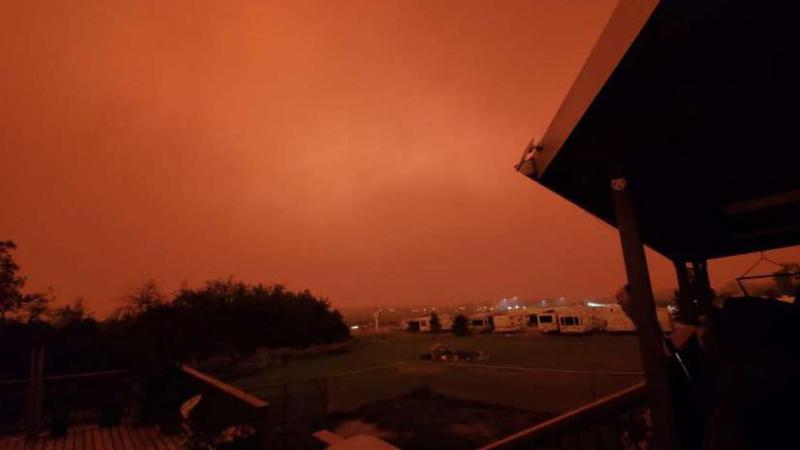
Some relief on the White Rock Lake fire lines as the rain and lower temperatures have diminished fire behaviour in the short term.
The BC Wildfire Service says the amount of rain received Monday, which was around 11 millimetres for Vernon, was not enough to have a lasting effect on the wildfire, however, it is giving ground crews a chance to strengthen existing guards and establish new lines.
“Areas of the fire that did not receive much rain will show heightened levels of fire behaviour especially during wind gusts,” stated an update from the BCWS on its website.
The reduced activity allowed the Wildfire Service to get a new size estimate on the fire that started July 13, with that now listed at 78,190 hectares, up by more than 14,000 hectares from the estimate of 64,720 ha. provided on Monday.
The Regional District of Central Okanagan is now estimating about 70 properties in the Ewings Landing and Killiney areas on the west side of Okanagan Lake sustained significant damage from the fire Sunday night/Monday morning, up from the earlier estimate of 50 to 60.
The Okanagan Indian Band has not released an estimate as yet of potential structural damage on its reserve.

There are 16 helicopters assigned to White Rock Lake. The helicopter fleet includes a Sikorsky 64 SkyCrane helicopter, ‘Lucille,’ which has a 10,000-litre tank that is fillable in less than one-minute. Lucille consumes up to 22,00 litres of fuel a day, can travel at up to 200 kilometers per hour, and has a range of 400 kilometers. (Photo credit: BC Wildfire Service)
==
UPDATE Aug. 17 5 a.m.
Vernon received 10.8 millimetres of rain on Monday.
==
Showers will have ‘short term impact’ on White Rock Lake wildfire
Aug 16, 2021 | 5:45 PM
Much needed rain has finally arrived to ease fire concerns in the Okanagan, at least in the short term.
Environment Canada is forecasting 5 to 10 millimetres of showers tonight.
It comes a day after the White Rock Lake wildfire caused significant damage to up to 60 structures in the Killiney and Ewings Landing areas of the Central Okanagan Regional District on Westside Road.
The popular Little Kingdom store was one of the structures that burned further north.
 Little Kingdom gas bar on Westside Road was damaged by the fire (Submitted photo)
The Okanagan Indian Band is not releasing information on possible structure damage on its reserve until it does more inspections, and talks to any impacted residents.
The fire size is now estimated at 64,720 hectares, an increase of over 3,400 hectares since early Sunday.
Forrest Tower, an information officer with the BC Wildfire Service, said the showers on Monday will provide a short term break in fire behaviour, but it’s not enough to put out the 64,720 hectare fire.
This fire spans the boundaries of multiple regional districts, municipalities, and the Okanagan Indian Band. The affected jurisdictions will issue evacuation Alerts and Orders on the recommendation of BC Wildfire Service.
Information for areas outside of the RDNO Electoral Area boundaries can be found with the local area authority as follows: • Regional District of Central Okanagan • Columbia Shuswap Regional District • Thompson-Nicola Regional District • Okanagan Indian Band • Township of Spallumcheen • City of Armstrong
The Fires of Note webpage for White Rock Lake wildfire is a good resource for residents to stay up to date.
Bunting Road Wildfire (#K41561)
The Bunting Road wildfire has merged with the Tsuius Creek (K41384) wildfire, and the total size is now mapped at 4733.7 ha. High winds yesterday caused increased fire activity to the south, but helicopters were able to bucket this area with success.
Crews are continuing with hand ignitions on the south and west sides. A small scale planned ignition on the west side was completed on Sunday, August 15 between established guards east of Mabel Lake, south of Torrent Creek and north of Mable Smyth Road.
This operation removed a pocket of unburned area and decreased ability for the fire to challenge guards in this location. On the west side, crews and heavy equipment have made significant progress securing this side of the fire, nearest to Mabel Lake.
A machine guard was constructed to protect structures along the Mabel Lake Forest Service Road. A thermal imaging scan was completed on the west side on August 10, which will provide location information for hot spot targets that crews will continue to action.
On the north side, crews have completed the machine guard and direct attack operation to secure the guard. The Evacuation Alert and Order for this fire remain in place and are unchanged since it was issued on July 26, 2021. There are currently 16 firefighters, 14 pieces of heavy equipment, and the Shuswap Complex has 10 helicopters available should they be required.
The Mabel Lake Forest Service Road remains closed. Persons who drive into the active fire area create a safety hazard to themselves and the responders in this active worksite.
Please respect the firefighting efforts and stay clear. The Fires of Note webpage for the Bunting Road wildfire is a good resource for residents to stay up to date.
Winnifred Creek Wildfire (#K42042)
BC Wildfire Service has not reported any significant changes to this fire. This Evacuation Alert remains in effect and unchanged since it was issued on July 20.
Please note that Provincial campgrounds and recreation sites are under the jurisdiction of the Government of British Columbia. Evacuation Alerts and Orders for those sites are issued by the Province.
Those wishing to drive through or near this area are encouraged to visit DriveBC’s website to check for closures before departing.